Property Record
1014 Mantua Pike, Wenonah, NJ 08090
NEARBY LISTINGS FOR SALE OR LEASE
Property Detail
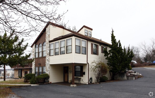
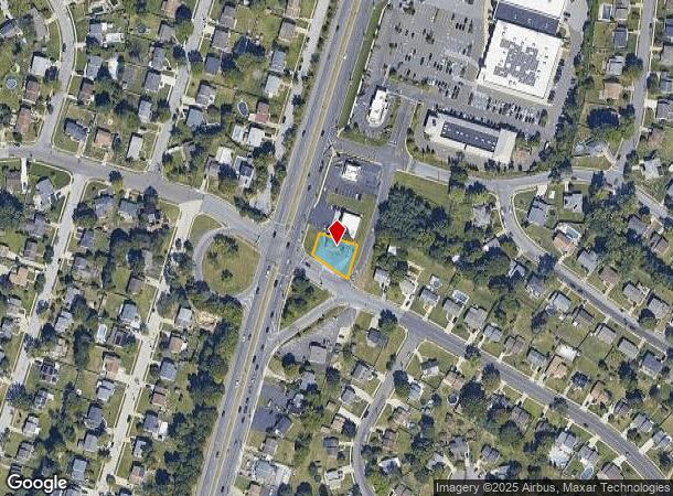
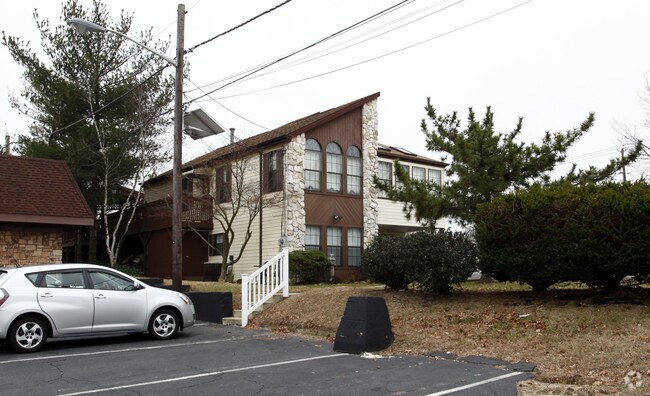
1014 Mantua Pike
Philadelphia-Camden-Wilmington, PA-NJ-DE-MD
Oak Valley Sec 16
02-00585-0000-00018
FACILITY NAME: OFFICES
Officebuilding
Gloucester
X
New Jersey
34015C0091F
18
2024
0.16 AC
2025
Gloucester County
501107
Philadelphia
1,820 SF
DEMOGRAPHICS near 1014 Mantua Pike
1 Mile
3 Mile
5 Mile
2024 Total Population
11,002
62,625
124,822
2029 Population
11,388
64,698
128,826
Pop Growth 2024-2029
+ 3.51%
+ 3.31%
+ 3.21%
Average Age
41
41
41
2024 Total Households
4,251
24,685
48,672
HH Growth 2024-2029
+ 3.65%
+ 3.35%
+ 3.22%
Median Household Inc
$92,569
$88,374
$89,552
Avg Household Size
2.60
2.50
2.50
2024 Avg HH Vehicles
2.00
2.00
2.00
Median Home Value
$216,083
$247,938
$250,913
Median Year Built
1965
1971
1972
Nearby Places
Map Layers
Map Styles
 Street
 Aerial
- Restaurants
- Banks
- Shops
- Fitness
- Groceries
PUBLIC TRANSPORTATION
AIRPORT
Philadelphia International
DRIVE
WALK
Distance
Philadelphia International
33 min
17.5 mi
Trenton Mercer
DRIVE
WALK
Distance
Trenton Mercer
66 min
44.7 mi
Atlantic City International
DRIVE
WALK
Distance
Atlantic City International
83 min
47.5 mi
Freight Ports
Broadway Terminal - Pier 5
DRIVE
WALK
Distance
Broadway Terminal - Pier 5
16 min
7.6 mi
Nearby Properties
Address
Land Use
TOTAL SIZE
Lot Size
Zoning
Address
Land Use
TOTAL SIZE
Lot Size
Zoning
69.05 AC
M2
Address
Land Use
TOTAL SIZE
Lot Size
Zoning
32.64 AC
INS
Address
Land Use
TOTAL SIZE
Lot Size
Zoning
1.66 AC
R01
Address
Land Use
TOTAL SIZE
Lot Size
Zoning
57.58 AC
C
Address
Land Use
TOTAL SIZE
Lot Size
Zoning
32.20 AC
R-1
Address
Land Use
TOTAL SIZE
Lot Size
Zoning
21.32 AC
Address
Land Use
TOTAL SIZE
Lot Size
Zoning
35.50 AC
R4
Address
Land Use
TOTAL SIZE
Lot Size
Zoning
32.88 AC
M1
Address
Land Use
TOTAL SIZE
Lot Size
Zoning
Address
Land Use
TOTAL SIZE
Lot Size
Zoning
63.46 AC
INS
Address
Land Use
TOTAL SIZE
Lot Size
Zoning
29.23 AC
BC3
Address
Land Use
TOTAL SIZE
Lot Size
Zoning
22.60 AC
R4
Address
Land Use
TOTAL SIZE
Lot Size
Zoning
38.17 AC
R4
Address
Land Use
TOTAL SIZE
Lot Size
Zoning
24.27 AC
M2
Address
Land Use
TOTAL SIZE
Lot Size
Zoning
21.16 AC
INS
Address
Land Use
TOTAL SIZE
Lot Size
Zoning
3.22 AC
PA
Address
Land Use
TOTAL SIZE
Lot Size
Zoning
1.11 AC
R4
Address
Land Use
TOTAL SIZE
Lot Size
Zoning
55.38 AC
M2
Address
Land Use
TOTAL SIZE
Lot Size
Zoning
111.40 AC
RRC
Address
Land Use
TOTAL SIZE
Lot Size
Zoning
36.52 AC
M1
Address
Land Use
TOTAL SIZE
Lot Size
Zoning
21.81 AC
RM2
Address
Land Use
TOTAL SIZE
Lot Size
Zoning
31 AC
M1
Address
Land Use
TOTAL SIZE
Lot Size
Zoning
Address
Land Use
TOTAL SIZE
Lot Size
Zoning
12.14 AC
Address
Land Use
TOTAL SIZE
Lot Size
Zoning
19.34 AC
R1
Address
Land Use
TOTAL SIZE
Lot Size
Zoning
27.18 AC
M1
Address
Land Use
TOTAL SIZE
Lot Size
Zoning
7.01 AC
R11
Address
Land Use
TOTAL SIZE
Lot Size
Zoning
9,576 SF
1.14 AC
MH
Address
Land Use
TOTAL SIZE
Lot Size
Zoning
14.11 AC
SC
Address
Land Use
TOTAL SIZE
Lot Size
Zoning
30.23 AC
The World's #1 Commercial Real Estate Marketplace
Connect with us
© 2025 CoStar Group
The information above has been obtained from sources believed reliable. While we do not doubt its accuracy we have not verified it and make no guarantee, warranty or representation about it. It is your responsibility to independently confirm its accuracy and completeness. Any projections, opinions, assumptions, or estimates used are for example only and do not represent the current or future performance of the property. The value of this transaction to you depends on tax and other factors which should be evaluated by your tax, financial, and legal advisors. You and your advisors should conduct a careful, independent investigation of the property to determine to your satisfaction the suitability of the property for your needs.